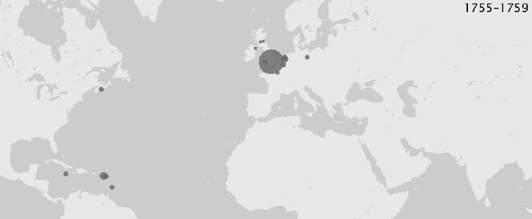
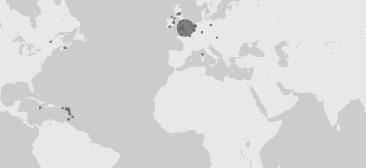
One of the key datasets in my work concerns North American newspapers’ citations to newspapers abroad. The maps below show how these citations changed over the late eighteenth century. Larger node sizes indicate a greater number of citations. Keep in mind that their sizes are not precisely proportional.
A few things to note:
- The London node remains the same size throughout, representing the largest share of citations. But in the 1790s, a few other nodes (notably Paris and Amsterdam) rival its significance.
- U.S. newspapers began to regularly cite news from the Caribbean (esp. the French Caribbean), Canada, Ireland, Spanish Louisiana, and India only in the 1780s and 1790s.
- Engagement with foreign newspapers did not steadily grow in all places. In many cases, newspapers only lasted for a year or two, or an event only drew readers’ attention for a brief moment. As a result, a few places (Cairo, Corsica, parts of the Holy Roman Empire) disappear from the map over time.
- WordPress unfortunately compresses gifs like this, so the circles and the dates look a bit boxy. Apologies.